Drone Captures Stunning Aerial Images of Iceland, In Case You Need Another Reason to Go
Polish landscape photographer Jakub Polomski, traveled to Iceland this summer, driving nearly 2500 miles around the country. Using a drone to capture these stunning aerial images of Iceland, they provide a striking bird’s eye view – as if you needed yet another reason to put Iceland on your must-see list.
Pictured above is Dyrhólaey lighthouse in the Vik area of Iceland. The lighthouse has been transformed into a boutique hotel, but it will be open for a limited time only, from September 1 to November 1, 2015.

Photo: Jakub Polomski
Lakagígar, Vatnajökull National Park
Lakagígar, or the Craters of Laki, is part of a volcanic system set between the glaciers of Mýrdalsjökull and Vatnajökull, in an area of fissures that run in a southwest to northeast direction.

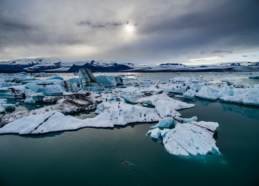
Jökulsárlón
Jökulsárlón, or “glacial river lagoon,” is a large glacial lake in southeast Iceland. It’s one of the country’s most popular destinations and has been the setting for a number of Hollywood films, including A View to a Kill, Die Another Day, Lara Croft: Tomb Raider and Batman Begins, as well as the reality TV series Amazing Race.


Fláajökull Glacier
Fláajökull is one of many glacier tongues flowing south from Vatnajokull glacier. The area offers good conditions for witnessing the ever-changing state of the glacier that plays a central role in shaping the landscape. Over the last century, its retreated more than a mile.

Geysir
Geysir sometimes known as The Great Geysir, is located in southwestern Iceland. It was the first geyser described in a printed source and the first known to modern Europeans. Though its eruptions can be infrequent, it can hurl boiling water up to 230 feet in the air.

Skogafoss
Skogafoss is a waterfall situated on the Skógá River in the south of Iceland at the cliffs of the former coastline.

Source: Earth Porm

Photo: Jakub Polomski
Lakagígar, Vatnajökull National Park
Lakagígar, or the Craters of Laki, is part of a volcanic system set between the glaciers of Mýrdalsjökull and Vatnajökull, in an area of fissures that run in a southwest to northeast direction.

Jökulsárlón
Jökulsárlón, or “glacial river lagoon,” is a large glacial lake in southeast Iceland. It’s one of the country’s most popular destinations and has been the setting for a number of Hollywood films, including A View to a Kill, Die Another Day, Lara Croft: Tomb Raider and Batman Begins, as well as the reality TV series Amazing Race.


Fláajökull Glacier
Fláajökull is one of many glacier tongues flowing south from Vatnajokull glacier. The area offers good conditions for witnessing the ever-changing state of the glacier that plays a central role in shaping the landscape. Over the last century, its retreated more than a mile.

Geysir
Geysir sometimes known as The Great Geysir, is located in southwestern Iceland. It was the first geyser described in a printed source and the first known to modern Europeans. Though its eruptions can be infrequent, it can hurl boiling water up to 230 feet in the air.

Skogafoss
Skogafoss is a waterfall situated on the Skógá River in the south of Iceland at the cliffs of the former coastline.

Source: Earth Porm
Related Posts:
- 40 Reasons To Visit Iceland With A Drone
- Iceland Opens Man-Made Ice Tunnel in Langjokull Glacier
- Discover Vatnajökull – the Largest Glacier in Iceland
- Frosted Iceland: My Glacial Roadtrip
- 37 Reasons Why You Need To Visit Iceland Right Now
- Breathtaking Landscapes Convey the Dazzling Beauty of Iceland
- The Magical Northern Lights In Iceland Will Take Your Breath Away.
- Top 10 Things to See and Do in Iceland
- Blue Iceland: Stunning Photos Of Icelandic Landscapes Taken With Infrared Technique
- The Relaxing Pleasures in Hot Blue Lagoon, Iceland
Drone Captures Stunning Aerial Images of Iceland, In Case You Need Another Reason to Go
 Reviewed by Eli Snow
on
2:16 AM
Rating:
 Reviewed by Eli Snow
on
2:16 AM
Rating:


Beautiful, beautiful, beautiful! <3
ReplyDelete